


QUICK FACTS
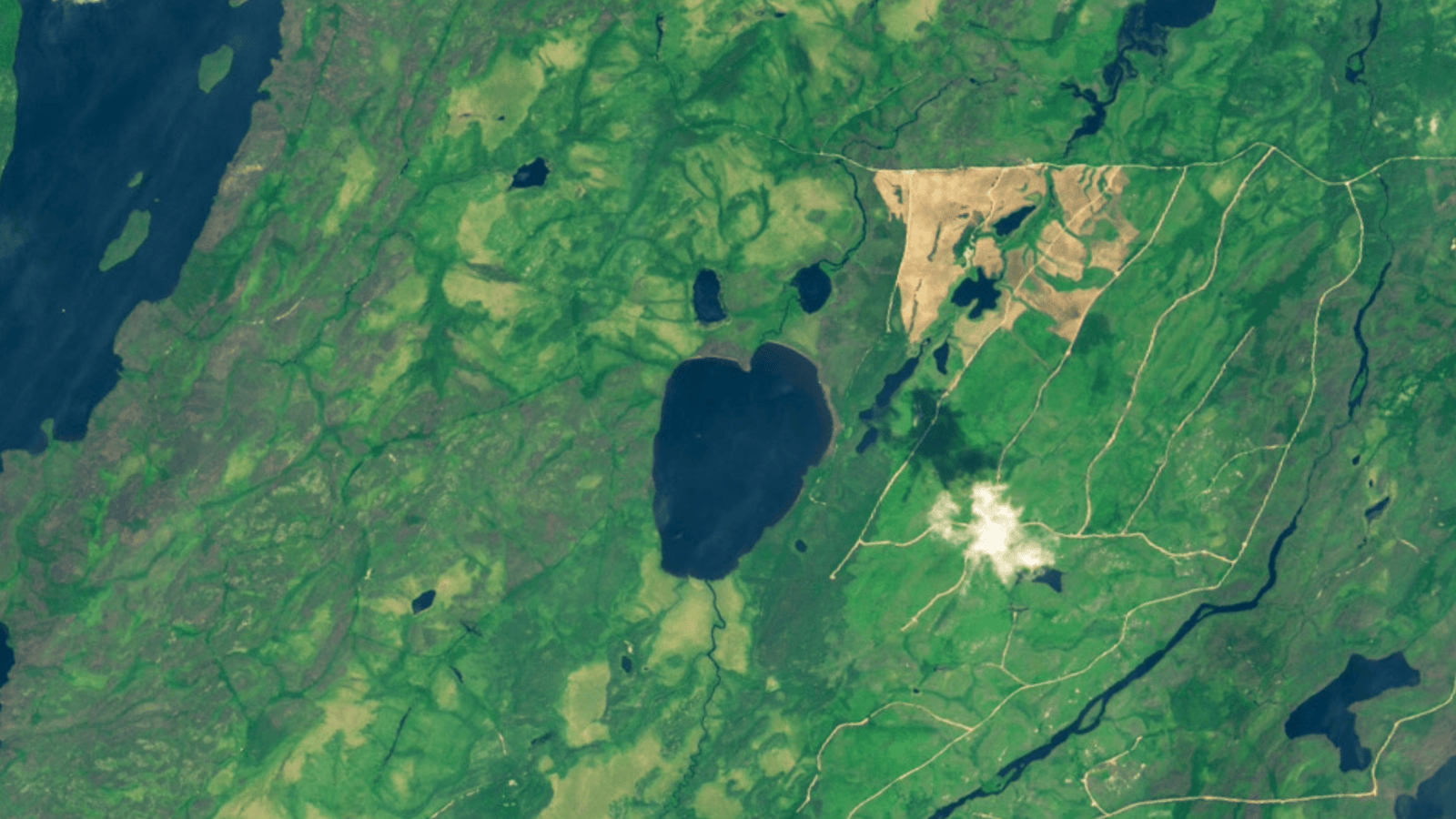
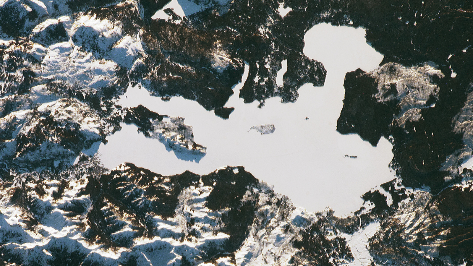
Where is it? Lake Rouge (Lac Rouge), Quebec, Canada [49.26218901, -75.39394153]
What’s in the photos? An emoji-like lake before and after it disappeared
Which satellite took the photos? Landsat 9
When were they taken? June 21, 2024 and June 15, 2025
Contrasting satellite snaps show the drastic transformation of an emoji-like lake in Canada that completely drained after its bank suddenly collapsed. Experts think a multitude of factors led to the rare event.
In May 2025, members of the Cree First Nation of Waswanipi — a nearby community of Indigenous people who used the lake for hunting, fishing and trapping — discovered that the lake had been totally emptied, after they found a thick coating of mud and dead fish spread across a nearby logging road, according to a statement released by the group.
After members of the Cree First Nation of Waswanipi traced the muddy trail back to its source, it became clear that Lake Rouge’s eastern bank had collapsed in a landslide-like event, causing its entire water supply to spill outward in a violent torrent known as an “outburst flood.” (The two smaller lakes next to Lake Rouge remained unaffected.)
“It looks like a natural disaster,” Irene Neeposh, chief of Waswanipi, told CBC News at the time. “We’ve never seen anything like this.”
Watch On
Satellite imagery shows that the lake’s sediment-laden water traveled around 6 miles (10 kilometers) before reaching the larger Doda Lake, which has a surface area of around 29 square miles (75 square km). Rather than flowing along any existing pathways, the water “punched through a row of smaller lakes and ponds” to reach its final destination, according to NASA’s Earth Observatory.
The sediment in the water quickly spread throughout Doda Lake, turning the larger body of water into a massive, muddy puddle. The nearby Father Lake (also called Priest Lake), which is around the same size as Doda Lake, was not impacted by the sediment, despite being adjacent to the polluted waterway.
While the exact timing of the outburst flood is unknown, additional satellite imagery revealed it must have occurred between April 29 and May 14, 2025, Live Science’s sister site Space.com previously reported.
Researchers told The Guardian that it is extremely rare to see an outburst flood in anything other than glacial lakes or human-made reservoirs, which have banks made of ice or concrete that can suddenly crack and break apart.
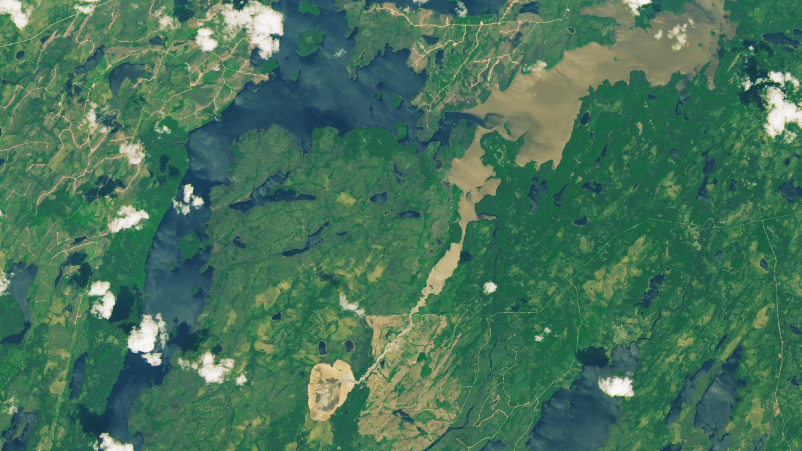

The outburst flood left a muddy trail across the surrounding landscape as sediment rich water flowed from Lake Rouge to Doda Lake.
(Image credit: NASA/Landsat)
Initially, experts assumed the lake bank’s collapse was simply due to that winter’s large snowfall, which led to an unusually high water level. However, it soon became clear that other factors were at play.
First, the area surrounding Lake Rouge was significantly impacted by major wildfires in 2019 and again in 2023, which was one of the worst years for wildfires in the country’s history. This unprecedented wildfire season removed vegetation from the area, making the topsoil less stable. What’s more, scorched earth does not readily absorb water, so it could not reduce the pressure applied to the banks as it otherwise would.
Second, the forests around the lake have been largely cleared by logging activities in recent decades, which has led to snow melting faster. This means bodies like Lake Rogue fill up much more quickly than they otherwise would.
Parts of Canada’s landscape, including Quebec, are also less resilient to environmental stressors because they were largely covered by a massive ice sheet until around 20,000 years ago.
“It’s a very young landscape that’s evolving very fast,” François-Nicolas Robinne, a forest hydrologist with the Government of Alberta, told The Guardian. If the lake’s collapse hadn’t happened in 2025, it may have occurred the next year or “a century from now,” but it would have happened eventually, he added.
Some researchers, including Robinne, likened the outburst flood to a 2024 incident in British Columbia’s Chilcotin River, where a landslide completely dammed the waterway and briefly trapped a population of endangered salmon on the wrong side.
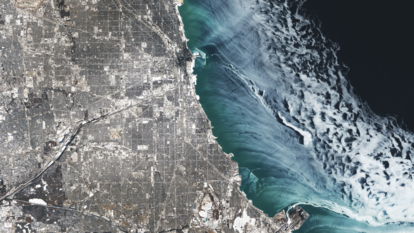
A 2025 satellite image shows a series of ghostly ice swirls sculpted on the surface of Lake Michigan by strong winds during an extreme cold snap that covered Chicago in a blanket of snow.
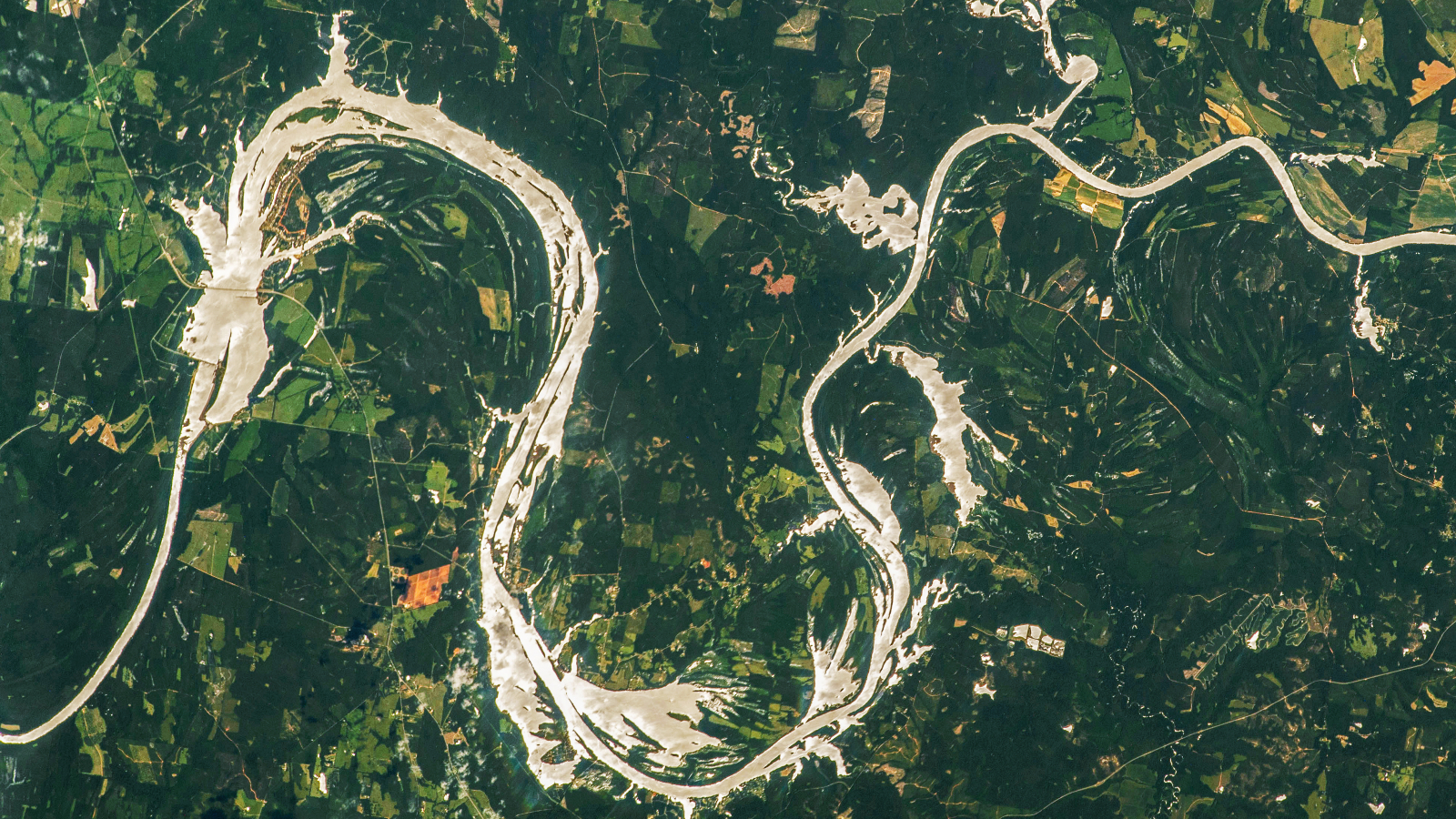
A 2023 astronaut photo shows the moment the Alabama River briefly morphed into an undulating golden serpent, similar in shape to a Chinese dragon. This temporary transformation was the result of a rare mirror-like phenomenon known as a “sunglint.”
A 2022 astronaut photo shows a thick blanket of snow covering Yellowstone Lake, transforming the frozen body of water into a featureless white void. But below the ice lie some of Earth’s hottest hydrothermal vents.


