





IBM and NASA have partnered to create a new artificial intelligence (AI) model capable of processing decades of lunar data so scientists can more accurately map the moon’s surface one day.
Decades of robotic lunar missions have left scientists with a massive, disjointed trove of data. Traditionally, this data has been parsed by limited transformer models such as SwinV2-B, created in 2022 as a general-purpose model to understand images and improve accuracy on photo recognition and related vision tasks. Spacecraft orbiting the moon captured this data using a mismatched array of sensors, without an accessible way to analyze or utilize it.
Specifically, images from high-resolution optical cameras, laser altimeters, radar reflectance tools and spectrometers that measure elemental density have created huge datasets — but unifying them into a cohesive picture of the lunar surface has been a labor-intensive and computationally demanding process.
Latest Videos FromLive Science
To crack the data bottleneck, researchers from NASA and IBM teamed up to build the Lunar Foundation Model (LFM). This agile AI system is designed to piece together multimodal, multiresolution data to build a detailed picture of the lunar surface to support future missions. The team published their findings Sept. 10 in a technical paper shared with Live Science.
Scientists have collected troves of data about the moon over many decades — but much of it is disjointed and difficult to analyze.
(Image credit: IBM)
The scientists wanted to build a single, reusable backbone AI model that would be freely available to scientists via the open-source AI model repository Hugging Face. Because the model is open-source, researchers could fine-tune the AI to tackle specific questions as part of different projects.
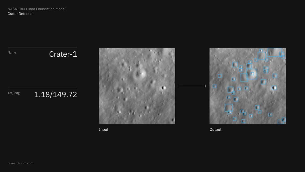
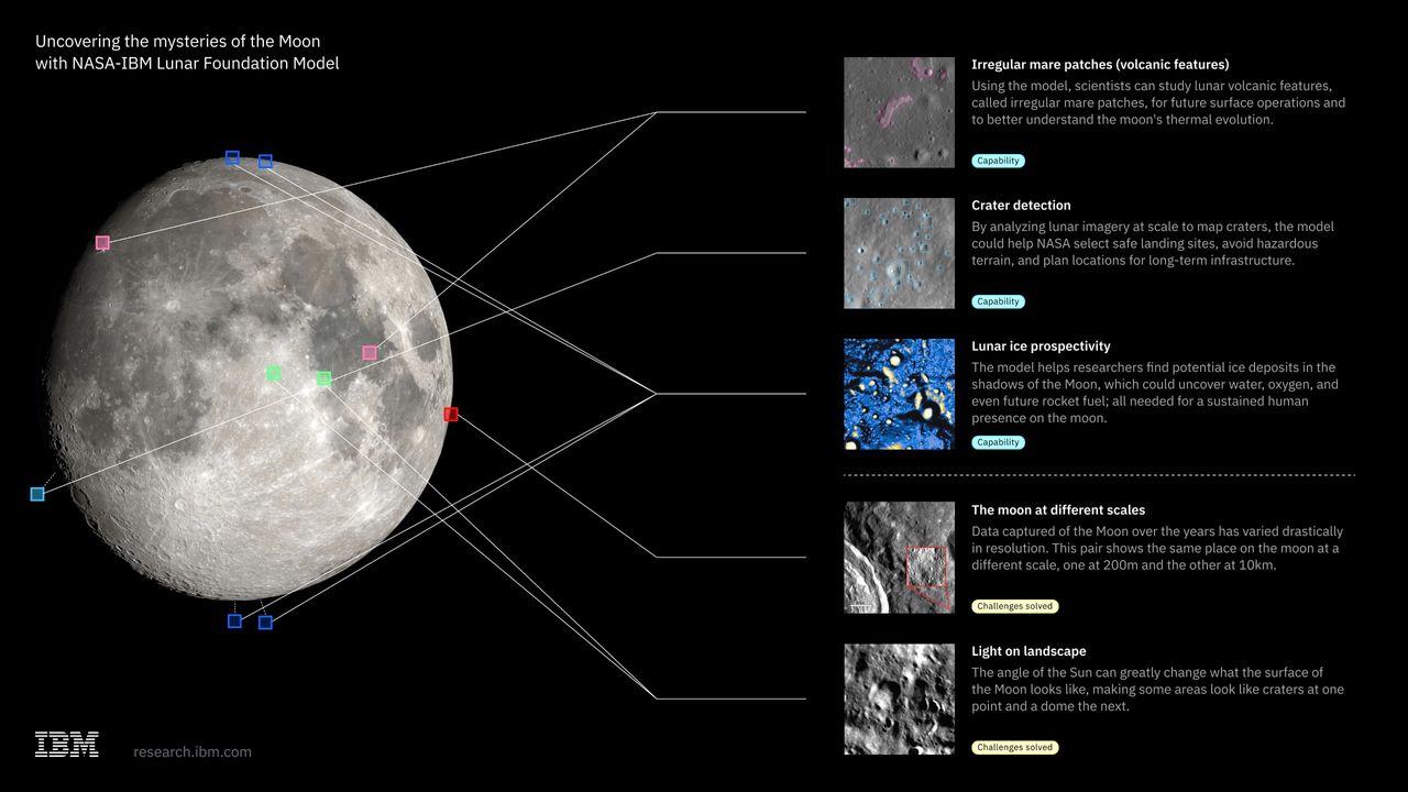
For NASA, this includes thorny issues such as generating a reliable crater map so researchers can plot safe landing zones, or analyzing those craters for clues about the chemical makeup of the moon’s interior and its history.
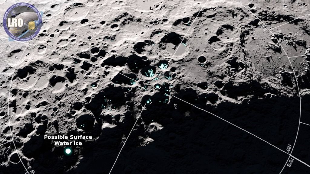
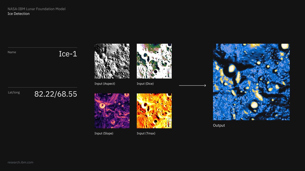
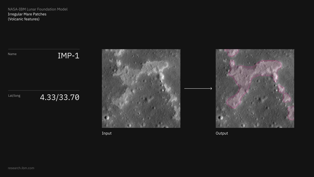
LFM also enables scientists to comb through the data for heavily shadowed sites on the moon that often conceal subsurface ice, which is critical for establishing long-term lunar bases. Volcanic activity can be tracked and collated too, which will allow future projects to avoid unstable terrain and reveal insight into the moon’s thermal evolution.
Get the world’s most fascinating discoveries delivered straight to your inbox.
Unique challenges
Processing lunar observations presents unique computational challenges that differ from those of similar models, which cover things like weather, geospatial data and heliophysics. NASA’s Lunar Reconnaissance Orbiter and other spacecraft collect measurements across vastly different spatial scales, ranging from broad regional maps at a resolution of 100 meters per pixel down to terrain scans resolving at 1 m per pixel.
Because the moon lacks an atmosphere, extreme sunlight geometry is an issue, creating deep, deceptive shadows. Sunlight can also wash out subtle geological details, depending on when an image was captured.
To overcome these problems, the team compiled a layered benchmark dataset named SomBench, made up of nearly 2 million overlapping map patches called tiles. SomBench organizes that data into aligned tracks so data from completely different instruments, or imagery taken at different resolutions or angles, all end up together as long as they’re capturing the same tiles.
The lower-resolution layers provide wide-angle overviews, as well as ultraviolet reflectance and elevation data. High-res layers combine tight, detailed camera shots with meter-scale terrain, slope and orientation maps. Specialized readings of thermal behavior, surface mineralogy and local gravitational anomalies also get layered in.
Image 1 of 4

(Image credit: IBM)
(Image credit: IBM)
(Image credit: IBM)
(Image credit: IBM)
LFM learns to interpret all that layered data through a technique called masked-token learning, which is where parts of a dataset are hidden so the AI has to fill in the blanks. During training, the AI is shown a portion of a lunar tile, like its visible light appearance and elevation, and nothing else. The model then continuously predicts the concealed information across millions of examples, and learns the relationships between elements like lighting, terrain structure and physical geography.
Lighting analysis is built directly into the model’s core architecture. Rather than forcing the model to infer light levels solely from shadows, researchers supplied explicit metadata describing solar angles and spacecraft positions. This allows the model to use its processing power to recognize actual terrain features rather than getting tricked by shadows.
One giant leap
The AI model performed well across four tasks it was evaluated on. In crater detection, it outperformed SwinV2-B by nearly 19% using half as many training labels. When estimating polar ice prospectivity within the top meter of regolith (lunar dust and rocks), LFM maintained strong predictive power with fewer data channels and reduced errors in identifying areas with high potential for lunar ice by up to 22% compared with SwinV2-B. Its performance on meter-scale crater mapping and rare volcanic landforms was similarly competitive with top custom models.
Scientists can customize LFM using lightweight techniques like low-rank adaptation — a way to fine-tune an AI by changing a tiny set of weights and not touching most of the original model. This allows researchers to tailor the model to specialized exploration tasks, without the steep computing costs of training an AI from scratch.

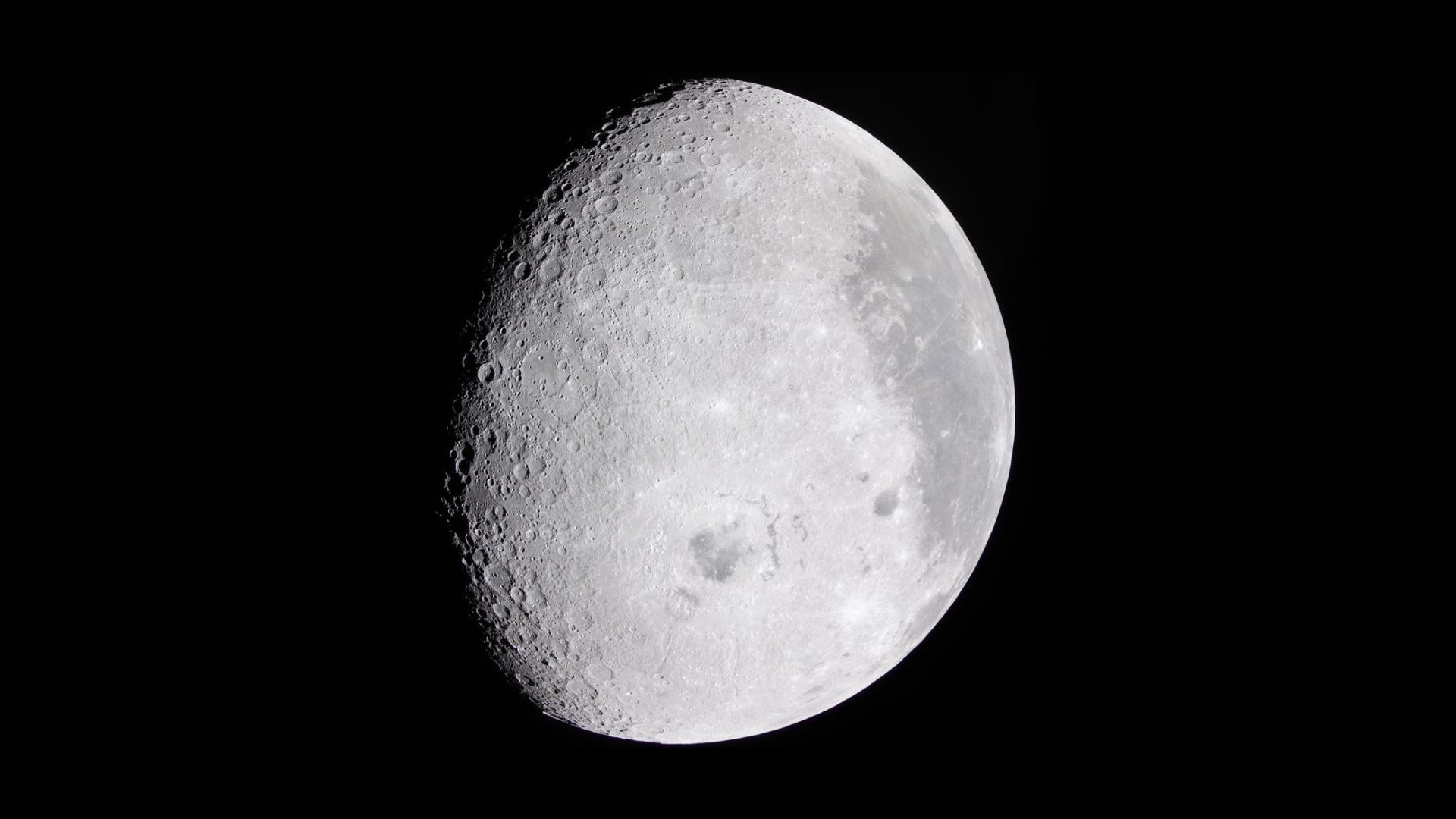
LFM will be made available to researchers freely through the open-source AI repository Hugging Face so that teams can tailor it to their specific needs when studying the lunar surface.
(Image credit: NASA)
However, the researchers cautioned in a statement that the system best serves as a pattern-recognition assistant and is not a replacement for direct physical measurements. Nonetheless, the team said the model represents a major leap toward transforming decades of raw data into a unified, intelligent toolkit for future robotic and crewed lunar missions.
In the near term, scientists will likely use the LFM as a backbone for key lunar remote-sensing tasks, while the long process of fine-tuning it ramps up. Over time, the model will be refined for tasks like improved crater detection and mapping, segmenting subtle geomorphic units such as irregular mare (volcanic activity) patches, and improving polar ice detection by integrating terrain, illumination, and thermal layers.