QUICK FACTS
Where is it? Mount Nyamuragira and Mount Nyiragongo, Congo [-1.46079851, 29.22711414]
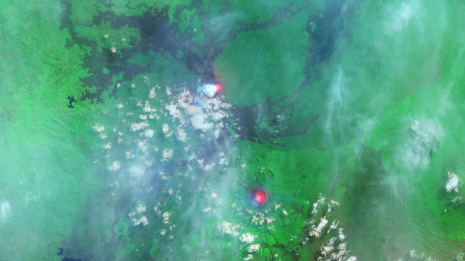
What’s in the photo? Infrared images of lava lakes that emerged during simultaneous volcanic eruptions
Which satellite took the photo? Landsat 8
When was it taken? June 30, 2014
This striking, false-color satellite image shows the intense heat coming from a pair of lava lakes that emerged on simultaneously erupting volcanoes in Congo. The neighboring peaks are among Africa’s most active — and deadly — volcanoes.
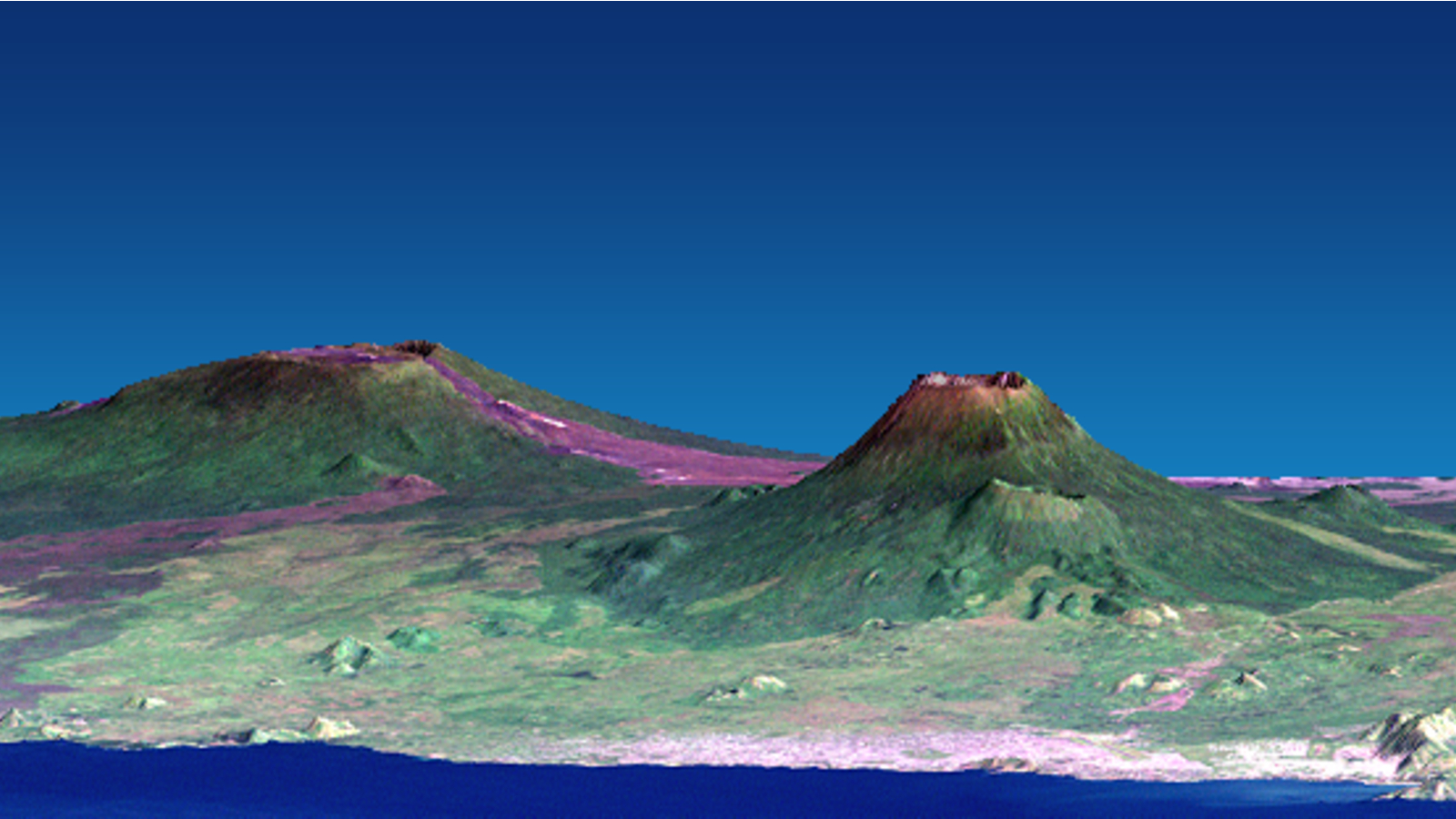
Mount Nyamuragira (top of image) and Mount Nyiragongo (bottom of image) are roughly 6 miles (10 kilometers) apart and are located just north of the city of Goma, which is home to more than 1 million people.
Nyamuragira is a dome-shaped shield volcano that stands up to 10,033 feet (3,058 meters) tall, while Nyiragongo is a stratovolcano, with a steep cone that towers up to 11,385 feet (3,470 m) above ground level.
The satellite photo was taken a few weeks after Nyamuragira began erupting for the first time since March 2012. This eruption ceased in May 2016, but the volcano has since had two more eruptions: from November 2016 to May 2017, and again in April 2018, which is still ongoing. Meanwhile, Nyiragongo has been continuously erupting since May 2002.
Related: See all the best images of Earth from space
Sizeable lava lakes were spotted at the summits of both volcanoes during the simultaneous eruptions. The lava lake at Nyiragongo is particularly interesting because stratovolcanoes do not normally support these features. At various points over the last two decades, this fiery pool has been the biggest lava lake on Earth, according to a 2021 study.
The image was captured in infrared, which makes the lava lakes appear to glow red and gives the surrounding vegetation a bright green coloration, according to NASA’s Earth Observatory.
Double trouble
Nyamuragira and Nyiragongo both formed around 12,000 years ago during a period of increased activity along the Kameronze fault line, which lies directly between the two volcanoes, according to the 2021 study. As a result, their activity is partially linked, despite being separate entities.
The volcanoes are highly active and have jointly erupted around 60 times since 1900. Together, the pair is believed to be responsible for around 40% of Africa’s recorded volcanic eruptions. And some of their most recent outbursts have been particularly intense.

Nyamuragira is the more active of the two volcanoes and has frequently spawned smaller, temporary volcanoes on its flank. The most recent was “Murara,” a cinder cone that emerged between 1976 and 1977. The mountain is also surrounded by old lava flows that spilled down its slopes (and are visible in the satellite photo).
In November 2011, a 1,300-foot-tall (400 m) fountain of lava shot out of the erupting volcano, according to local reports. This is believed to have been the largest single outburst there for at least a century.
However, Nyiragongo is the closest to Goma and, therefore, the more dangerous of the pair. When lava flows spill down the volcano’s steep slopes, they can reach high speeds, giving locals little warning.
In January 1977, the volcano unleashed the fastest lava flow in recorded history, reaching speeds of up to 62 mph (100 km/h), which killed around 2,000 people in Goma and the surrounding areas, according to Guinness World Records.
In January 2002, a similar eruption killed around 250 people and caused extensive damage to homes, leaving more than 100,000 people homeless and triggering a refugee crisis, according to Britannica. The most recent incident occurred in May 2021, when at least 31 people died, according to CNN. However, in this case, several deaths resulted from traffic collisions as people attempted to evacuate the area.


