


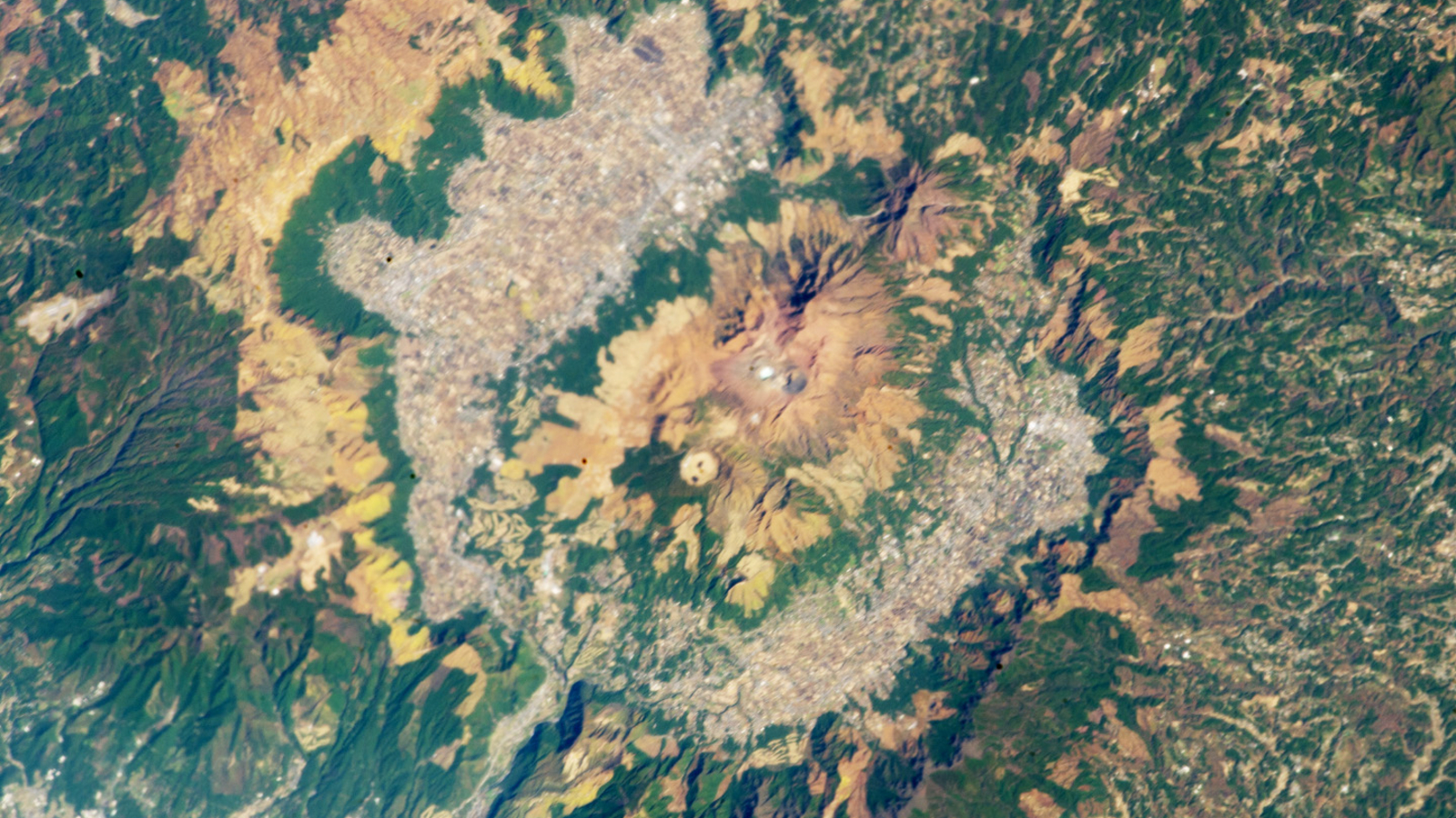

QUICK FACTS
Where is it? Aso Caldera, Japan [32.882046866, 131.08448854]
What’s in the photo? A giant caldera containing 17 different volcanoes
Who took the photo? An unnamed astronaut on board the International Space Station (ISS)
When was it taken? Nov. 18, 2012
This stunning astronaut photo shows the natural beauty of Japan’s Aso Caldera — a giant crater-like bowl containing 17 different volcanoes, leftover from major eruptions spanning over 200,000 years.
Aso Caldera, also known as Mount Aso or Asosan, sits in the heart of Kyushu, the third largest of Japan’s four major islands. The imposing structure measures up to 15 miles (24 kilometers) across and is surrounded by a ring-like ridge that reaches up to roughly 4,000 feet (1,200 meters) tall.
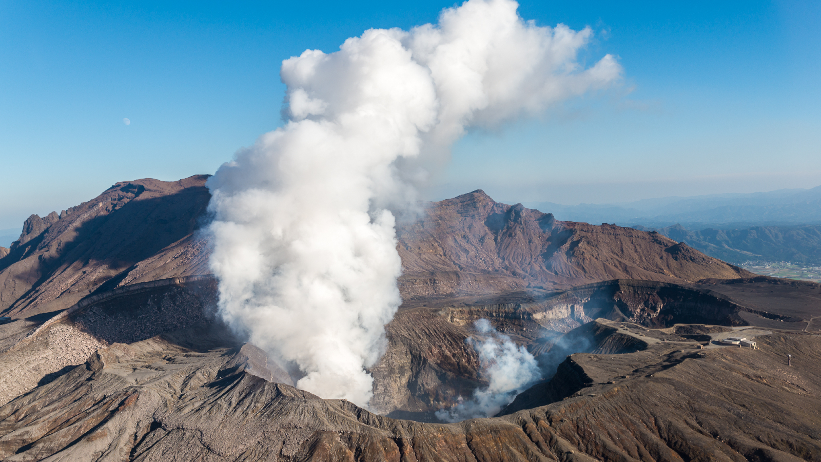
The caldera is home to 17 different volcanoes, ranging from small vents nestled within the landscape to sizable mountains that tower above their surroundings. The area’s five largest cones — Takadake, Nekodake, Nakadake, Kishimadake and Eboshidake — are grouped near the caldera’s center and are collectively known as “Aso Gogaku.” Each one of these lofty peaks is taller than the caldera’s outer rim.
Nakadake is one of the most active volcanoes in Japan and most recently erupted in October 2021, according to the Smithsonian Institution’s Global Volcanism Program. Two of the other central volcanoes, Kishimadake and Eboshidake, are also active but have not erupted for hundreds or thousands of years.
A 2018 study revealed that all three of these active peaks are fed by a large magma chamber located around 4 miles (6 km) below the surface.
Related: See all the best images of Earth from space

Collectively, Aso Caldera is considered to be one of Earth’s nine “supervolcanoes” because its network of volcanoes is technically capable of erupting in one massive explosion. However, similar to other superstructures, such as Yellowstone, the odds of this happening in the near or distant future are extremely small.
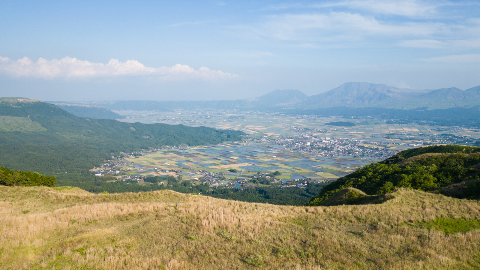
Today, the land between the central volcanoes and outer ridge is largely covered with urban areas and agricultural buildings, which gives it its speckled gray and white appearance, according to NASA’s Earth Observatory. But in the past, most of the caldera’s floor would have been covered by a trio of ancient lakes that have since dried up.
Ancient rivers that once drained these lakes also carved an opening in the caldera’s western wall (at the bottom of this image), which is now home to the only major road in and out of the caldera.
Several hotsprings are also dotted throughout the caldera, including Jigoku, which translates to “hell” in Japanese.
Explosive history
Aso was carved out by four major pyroclastic eruptions that occurred between 300,000 and 90,000 years ago, according to Earth Observatory. Most of Kyushu was covered by volcanic rock, known as tephra, as a result of these eruptions.
Thick ash deposits from the fourth and largest eruption have also been found on Hokkaido Island, around 900 miles (1,450 km) to the north of the caldera. Experts now believe that this outburst reached level 8 on the volcanic explosivity index, the highest possible level of any eruption, which is largely why Aso is still considered a supervolcano.
Kyushu and the rest of Japan are located along the Pacific Ring of Fire — a roughly 25,000-mile-long (40,000 km) arc encircling large parts of the Pacific Ocean basin, where tectonic plates intersect one another. This region contains roughly three-quarters of the world’s terrestrial volcanoes and is the site of around 90% of all earthquakes.
Aso is located directly above two intersecting fault lines where the Okinawa Plate and Amur Plate collide and the larger Pacific Plate is subducting beneath them both, which likely contributed to its explosive past.


