


A rare snowfall in the driest place on Earth has halted operations of one of the world’s premier telescope arrays, and climate change may mean the observatory will face more extreme weather events like this in the future.
The snow has blanketed part of the Atacama Desert, which gets less than an inch of rainfall per year and is home to home the Atacama Large Millimeter/submillimeter Array (ALMA), a large network of radio telescopes in northern Chile.
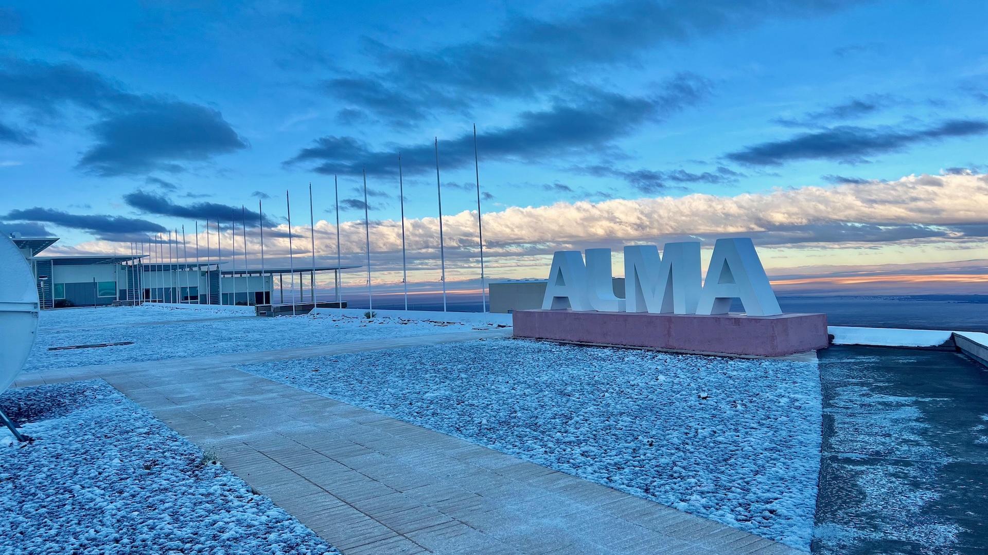
The snowfall occurred over ALMA’s Operations Support Facility, located at an altitude of 9,500 feet (2,900 meters) and about 1,050 miles (1,700 kilometers) north of Santiago. Scientific operations have been suspended since Thursday (June 26).
“There hasn’t been a record of snowfall at the base camp for over 10 years. It doesn’t snow every day at ALMA!” ALMA representatives told Live Science via WhatsApp.
ALMA’s radio telescope array is perched high on the Chajnantor Plateau — a desert plain at 16,800 feet (5,104 m) in Chile’s Antofagasta region — typically sees three snowfalls a year. The high plateau shared by Chile, Bolivia and Peru typically experiences snowstorms during two seasons: in February, during the “Altiplanic Winter,” driven by moist air masses from the Amazon; and from June to July, during the Southern Hemisphere’s winter, said Raúl Cordero, a climatologist at the University of Santiago.
“In winter, some storms are fueled by moisture from the Pacific, which can extend precipitation even to the Atacama Desert’s coastal areas,” Cordero told Live Science. At elevations above 16,400 feet (5,000 m), annual snowfall ranges from 8 to 31 inches (20 to 80 centimeters).
However, snowfall at 3,000 meters (9,840 feet), where ALMA’s base camp is located, “is much less frequent,” Cordero noted.
This week’s snowfall was triggered by unusual atmospheric instability affecting northern Chile. The Chilean Meteorological Directorate issued a snow and wind alert due to the passage of a “cold core” through the region, said meteorologist Elio Brufort. “We issued a wind alert for the Antofagasta region and areas further north, with gusts reaching 80 to 100 km/h [50-62 mph],” Brufort said to the local press.
The phenomenon was accompanied by heavy rainfall that occurred farther north, causing a stream to swell and damage several properties. Schools were ordered to close, and power outages and landslides were reported. So far, no casualties have been reported. A weather event of this magnitude has not been seen in nearly a decade.
Extreme conditions paralyze ALMA
As of Friday, ALMA reported to Live Science that the snowstorm remained active over the Chajnantor Plateau, so scientific operations continued to be suspended to protect the antennas from extreme weather conditions. Early Thursday morning, the observatory activated its “survival mode” safety protocol: In addition to the snowfall, temperatures had plummeted to 10 degrees Fahrenheit (minus 12 degrees Celsius) — with a wind chill of minus 18 F (minus 28 C) — making work at the high-altitude camp extremely difficult.
Image 1 of 2

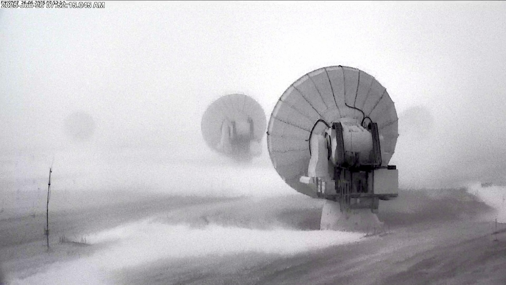
ALMA cameras captured the telescope facilities blanketed in snow.

As part of this protocol, all of ALMA’s large antennae have been reoriented downwind, helping to minimize potential damage from snow buildup or strong gusts.
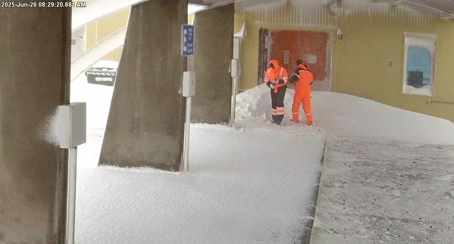
“Once the storm passes, snow-clearing teams are immediately activated to visually inspect each antenna before resuming observations,” ALMA representatives said. “This has to happen fast, as some of the best observing conditions occur just after a snowfall: the cold helps lower air humidity, which is what most interferes with our measurements.”
ALMA, which consists of 66 high-precision antennae spread across the Chajnantor Plateau, is an international collaboration that forms the most powerful radio telescope on the planet — and one designed to handle extreme weather events like this.
The fact that the snow halted operations raises questions about the array’s operations as the climate warms.
The Atacama Desert typically receives only 0.04 to 0.6 inch (1 to 15 millimeters)of precipitation per year, and many areas can go years without recording any measurable rain or snow.
Could events like this become more frequent? “That’s a good question,” Cordero replied.
While it’s still too early to link lower-altitude snowfalls in the desert directly to climate change, “climate models predict a potential increase in precipitation even in this hyper-arid region,” he concluded. “We still can’t say with certainty whether that increase is already underway.”


