


A “weird” river in the Himalayas may have pushed the peak of Mount Everest up by 164 feet (50 meters), scientists say.
According to a new study, a river roughly 46 miles (75 kilometers) from Everest was “captured” by another around 89,000 years ago. The erosion from this event carved away a huge gorge, leading to a loss of landmass that made the mountain experience a major growth spurt.
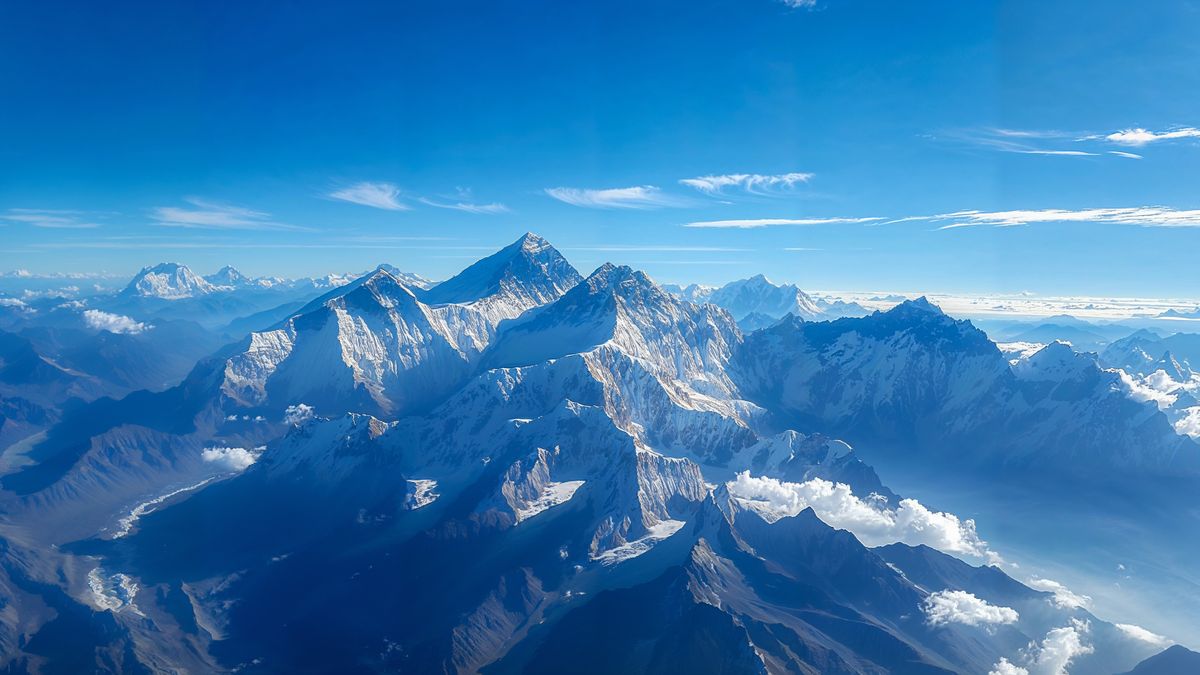
At 29,031.69 feet (8,848.86 m) above sea level, Mount Everest is Earth’s highest peak on land. But it “is taller than it should be,” study co-author Adam Smith, a researcher at University College London’s Earth Sciences department, told Live Science in an email. In the Himalayas, the height difference between most mountain peaks is about 164 to 328 feet (50 to 100 m). But Everest is 820 feet (250 m) higher than the next highest mountain, K2. “This perhaps hints that something interesting is going on,” Smith said.
GPS data shows Everest is growing at a rate of around 0.08 inches (2 millimeters) per year, which is higher than the expected rate of uplift for the mountain range. To find out the root cause, the researchers looked at whether the Himalayas’ unusual rivers could be driving the rise.
“The Arun River is weird, as it flows in an L shape,” Smith said. “Most rivers resemble trees, with a relatively straight trunk, and branches (tributaries) flowing into the trunk. However, the Arun flows E-W [east to west] along its upstream portion, before turning 90 degrees and flowing south through the Himalayas. This hints that perhaps the river has recently changed its form, and has maybe ‘captured’ another river.”
Related: Boiling rocks from Earth’s crust tore an ocean into Mongolia 410 million years ago
For the study, published Monday (Sept. 30) in the journal Nature Geoscience, the researchers used numerical models to simulate how the Kosi River network — which flows through China, Nepal and India — evolved over time. They then compared their models with the existing topography to work out which simulation fitted best.
The findings suggest that the Arun River (now a main tributary of the Kosi River) was captured by Kosi around 89,000 years ago. This diverted river led to a surge in river erosion, carving out the Arun River Gorge.
The creation of this gorge and erosion of the river, the researchers argue, would have removed enough landmass to make the surrounding land lighter, causing Everest to spring up. The mountain has risen between 50 and 164 feet (15 to 50 m) since the capture event, according to the models.
It’s unclear what caused the river to get captured, Smith said. It could have been one river eroding into another, with the Kosi River eroding backwards until it entered the Arun River and “stole” part of it, he said. Another possibility is that a glacial lake overflowed, unleashing a catastrophic flood that wiped out the natural barrier between the Kosi and Arun rivers. “We are not sure which mechanism is most likely,” Smith said.
Everest should continue getting bigger until the river network has fully responded to the changes that took place, Smith said. The next step in the research could be to look more closely at the gorge and other areas that the Arun River flowed over. This will enable them to narrow down dates for the capture event that the model can be checked against.


?")


