


QUICK FACTS
Where is it? Brooks, southern Alberta, Canada [50.586757475, -112.12895463]
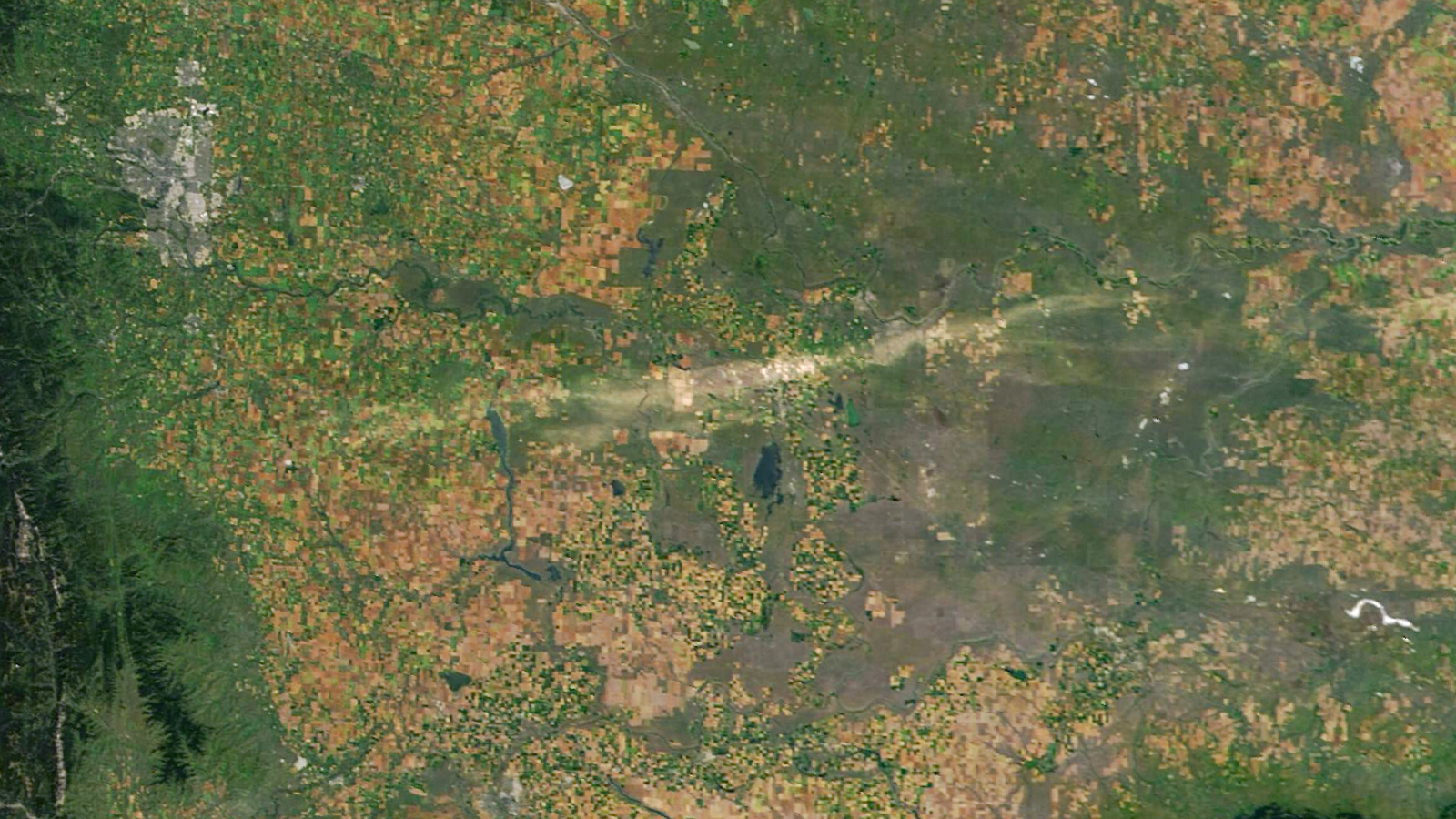
What’s in the photo? A 125-mile-long “scar” left behind by a destructive hail storm
Which satellite took the photo? NASA’s Aqua satellite
When was it taken? Aug. 24, 2025
This striking satellite image highlights the aftermath of a major hailstorm in Alberta, Canada, which carved a giant “scar” in the landscape, around half as long as the Grand Canyon. The extreme event, which pelted the ground with golf ball-size ice chunks, killed at least two animals.
While the storm produced few lightning strikes, it triggered a serious hailstorm and high winds that caused widespread damage to houses, vehicles and infrastructure. Some of the hailstones reached a maximum diameter of 2 inches (5 centimeters), and the associated winds reached speeds of over 75 mph (120 km/h) — equivalent to a Category 1 hurricane, according to The Weather Network.
In addition to damaging property, the giant balls of falling ice hammered into the ground and tore up vegetation. The result was a roughly 125-mile-long (200 kilometer) and 9-mile-wide (15 km) scar etched across the landscape, which was clearly visible from space.
Related: See all the best images of Earth from space
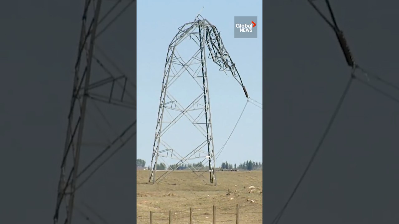
The worst-affected area was around Brooks, a small city located around 100 miles (160 km) southeast of Calgary (visible in the top left of the satellite image). The combination of supersized hail and high winds damaged local houses and vehicles, as well as wrecking nearby power pylons, some of which were bent at a near 90-degree angle, Canadian news outlet CBC reported.
“The whole front of the house is destroyed,” Brooks resident Colleen Foisy told CBC. “The front fence actually got ripped off of the cemented posts. My flowers in my garden got thrown around, branches from the trees. There’s hail damage all over my truck that’s only a year old. The cover to my boat got shredded.”
The high winds also blew over a large fence at the White Barn Fun Farm, located west of Brooks, killing a Bactrian camel (Camelus bactrianus) and pony that were “best friends,” the farm’s owner told CBC. A horse and several birds were also injured.

Watch On
“Hailstorm alley”
While this event was extreme, it is not unusual for such storms to appear in this part of Alberta, which is often dubbed “hailstorm alley.”
“The region’s climate and geography are conducive to storm development, and the area typically sees dozens of hail events each year,” Earth Observatory representatives wrote.
Over the last five years, hailstorm damage in Alberta has totaled more than 6 billion Canadian dollars ($4.3 billion), excluding damages from August’s storm, which are yet to be calculated, according to a recent report from Insurance Business magazine.
Some of the people affected by the most recent storm were still recovering from a similar event in July.
Researchers at NASA’s Langley Research Center are now working on a way of being able to better predict these damaging storms in advance, to help mitigate their impacts.
“With state-of-the-art identification techniques, we can quantify severe storm distribution and frequency with an exceptional level of consistency that’s only granted by satellite measurements,” Benjamin Scarino, a research scientist at the center, told Earth Observatory. “Long-term satellite data records allow us to provide the reinsurance industry, project partners, and the research community with valuable insights into severe storm activity and risk.”


