


QUICK FACTS
Where is it? Mount Arkanu, Libya [22.267325754, 24.7226055004]
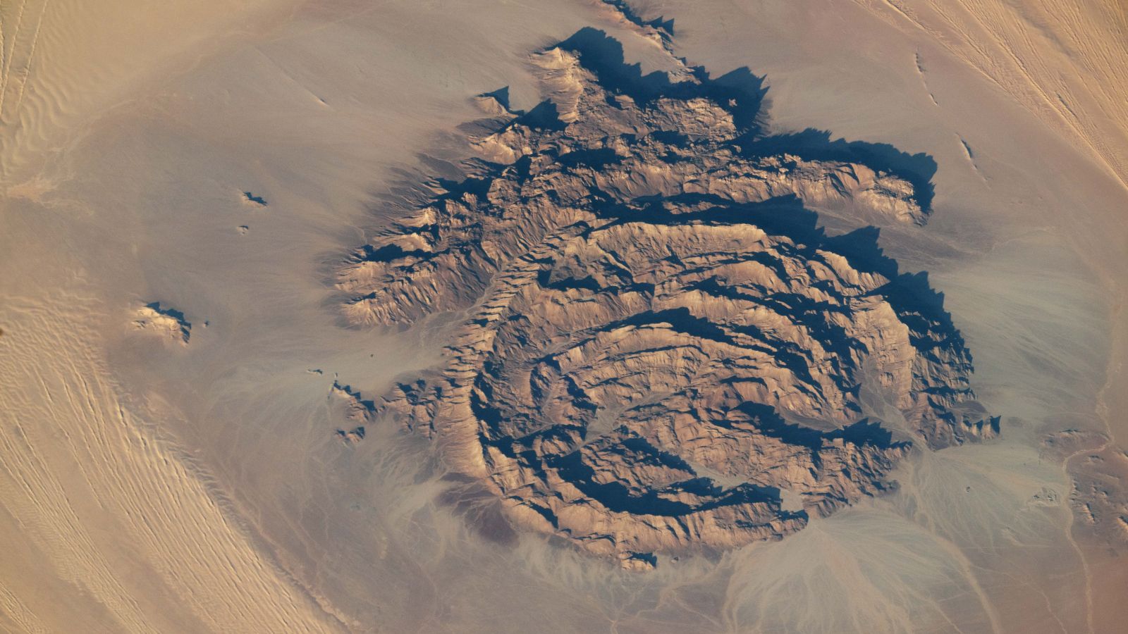
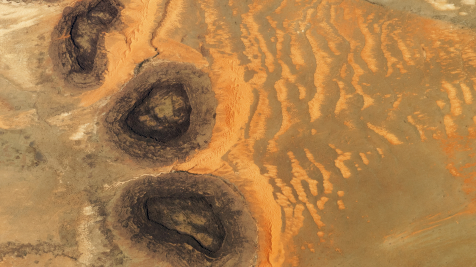
What’s in the photo? A massif of concentric rocky rings in the middle of the Sahara
Who took the photo? An unnamed astronaut on board the International Space Station
When was it taken? Sept. 13, 2025
This intriguing astronaut photo shows a series of rocky rings and their distinctive “hat” towering above a dune sea in the Sahara. The concentric, shadow-filled walls are home to ancient artworks and, occasionally, herds of cattle.
Due to the mountains’ shape, scientists previously assumed that the massif was an ancient impact crater that formed when a giant space rock slammed into the northeast Sahara. But more recent research has shown that the rocky rings are not of extraterrestrial origin.
Article continues below
Instead, the mountains were created when “magma [repeatedly] rose toward the surface and intruded into the surrounding rock,” according to NASA’s Earth Observatory. This formation process likely ended hundreds of millions of years ago but has not been properly dated.
“Repeated intrusion events produced a series of overlapping rings, their centers roughly aligned toward the southwest,” Earth Observatory representatives wrote. “The resulting ring complex — composed of igneous basalt and granite — is bordered to the north by a hat-shaped formation made of sandstone, limestone, and quartz layers.”
The massif has two large gaps in its outermost southern wall (bottom right in the photo). These have been slowly carved out by a pair of wadis, or ghost rivers, which sporadically fill with water when it rains. The phantom waterways can also be seen snaking through the dark plateau surrounding the complex.
This region of the Sahara is hyperarid; it gets only 1 to 5 millimeters (0.04 to 0.2 inches) of rain each year, according to the Earth Observatory. However, the massif receives between 5 and 10 mm (0.2 to 0.4 inches) of rain annually, due to a phenomenon known as “orographic precipitation,” which occurs when clouds form over raised landforms, according to the U.K. Met Office.
As a result of this additional water, the rings are partially filled with grasses, bushes and trees that the shadows from the towering peaks shelter from the desert’s scorching temperatures.
Cattle herding
The combination of shade, vegetation and occasional water has historically made the massif a popular destination for nomads traversing the surrounding dune seas.
Another massif, Mount Awaynat (sometimes spelled Uwaynat or Uweinat), is located roughly 12 miles (20 km) southeast and has provided similar benefits to desert wanderers for generations.
Some of the canyon-like walls of both Mount Arkanu and Mount Awaynat are covered with rock carvings, or petroglyphs, that were first discovered in 2003. These ancient artworks depict human fugures, along with cattle and other tethered animals, such as giraffes.
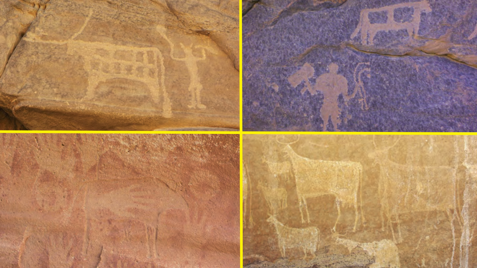

Early-20th-century explorers noted that members of the local bedouin tribe trekked their cattle herds to the massifs and left them inside to graze for up to three months at a time — and blocked up the holes created by the wadis to stop the animals from wandering off.
The cattle carvings within both structures suggest that this practice has been going on for thousands of years.
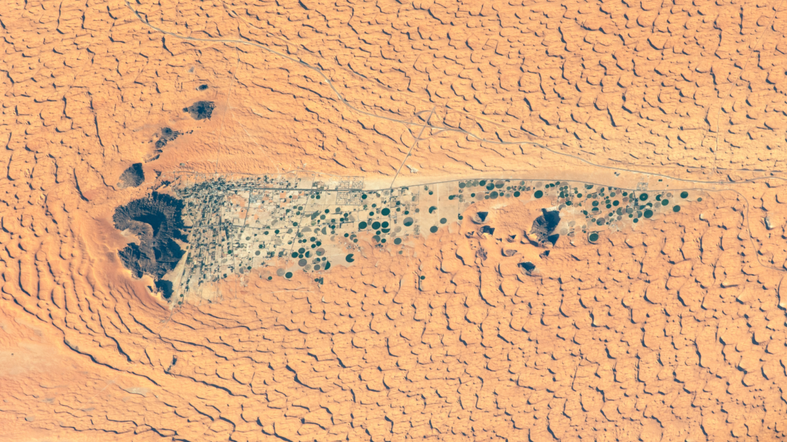
A 2020 astronaut photo shows the oasis town of Jubbah lurking within a paleolake in the wind shadow of Saudi Arabia’s “two camel-hump mountain.”
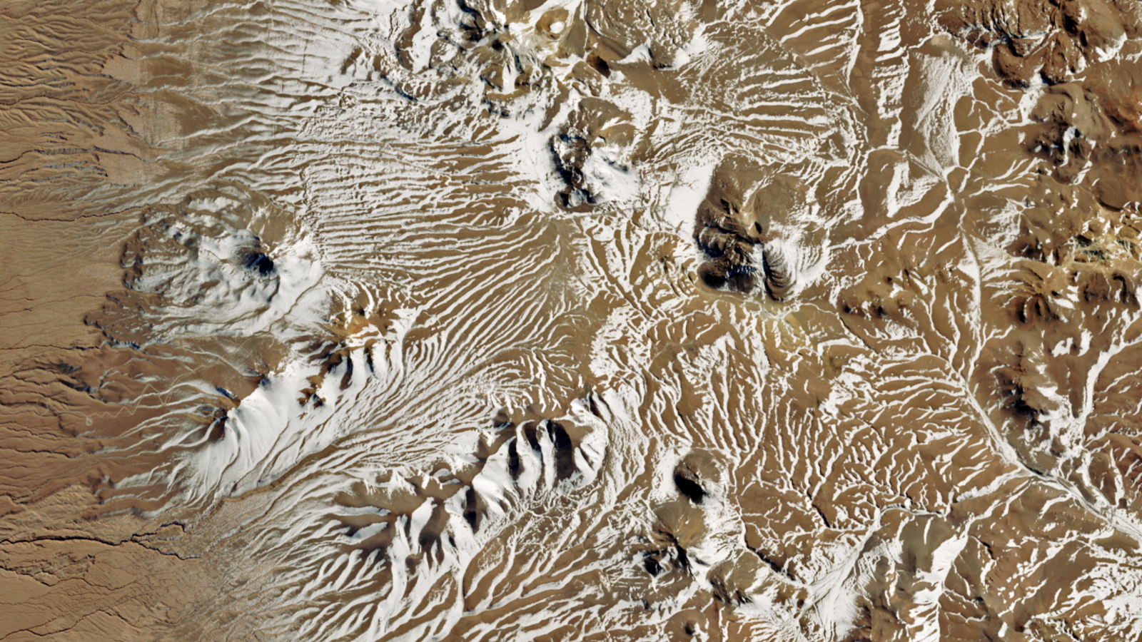
A 2025 satellite photo shows intricate snowy stripes painted across the Atacama Desert in Chile. The icy weather temporarily put one of the world’s largest telescopes into “survival mode.”
A 2023 astronaut photo shows three dark hills, or mesas, towering above part of the Sahara desert in southern Mauritania. The Paleozoic structures are remnants of a single ancient formation.


