


QUICK FACTS
Where is it? Bartica, Guyana [6.4073096658, -58.62373473]
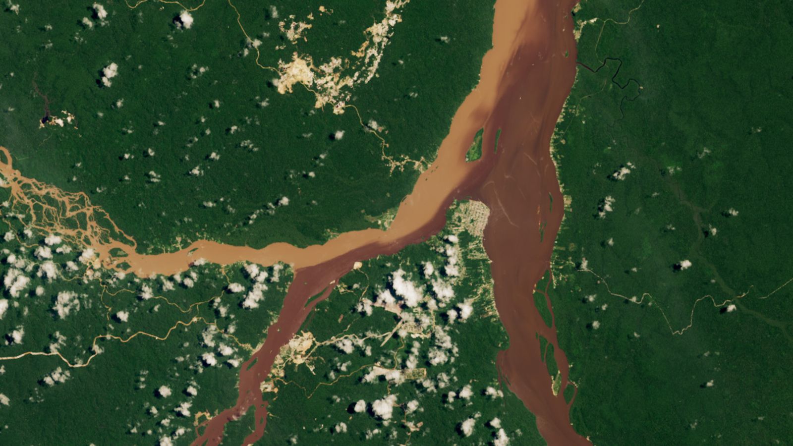
What’s in the photo? A trio of waterways merging into a striking “half-and-half” river
Which satellite took the photo? Landsat 8
When was it taken? Aug. 16, 2023
This striking satellite photo shows off the contrasting colors at the point where three rivers converge in Guyana. The multicolor waterways result from the country’s unique geology, as well as an increasingly disruptive human-caused factor.
This unique hydrology is linked to the Guiana Shield, a 1.7 billion-year-old geologic feature that covers Guyana as well as parts of Venezuela, Brazil, Suriname and French Guiana. The shield contains hard crystalline bedrock made up of rocks such as gneiss and granite, meaning it does not easily erode except from flowing water, which has carved out many routes through the region.
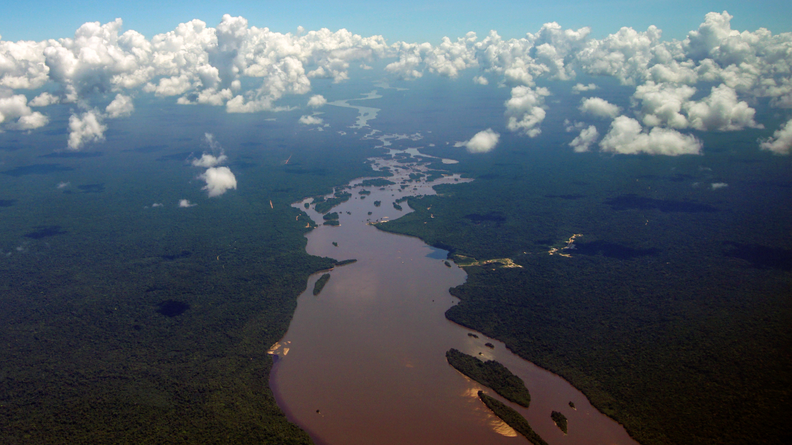
In this photo, two smaller rivers — the Cuyuni River (left) and the Mazaruni River (center left) — come together shortly before merging with the Essequibo River (center right) to form one of Guyana’s largest waterways.
The town of Bartica, which is home to around 15,000 people, is located on the piece of land that juts into the water at the point of the secondary merger. From there, the enlarged Essequibo River flows northward for around 30 miles (50 kilometers), before draining into the Atlantic Ocean.
Prior to merging, the Mazaruni and Essequibo are dark brown, which is likely the result of tannins — chemicals released by rotting vegetation that stain waterways via a process similar to tea brewing. The Cuyuni is light brown due to high levels of suspended sediment in its water, according to the Earth Observatory.
When the rivers meet, the lighter and darker waters do not readily mix because of the differences in density caused by varying levels of sediment.
While the presence of tannins is a natural phenomenon triggered by flooding, the high levels of sediment are the result of mining waste that is dumped in the Mazaruni.
“This image is from a wet time of year when all three rivers were running high and carrying a lot of sediment,” Evan Dethier, a hydrologist at Colby College in Maine, told the Earth Observatory. “But the Cuyuni is the clear outlier, which we can attribute to the intensity of mining upstream.”
Guyana is a hotspot for mining, largely because of its vast deposits of gold, diamonds and bauxite, as well as lithium, copper and nickel, which are also linked to the Guiana Shield, according to the U.S. Department of Commerce.

The country’s mining industry began in ernest in the mid-2000s, and since then, the concentration of sediment in the Cuyuni has likely increased tenfold, Dethier said. Similar changes have been documented in rivers across the planet.
A 2022 study led by Dethier revealed that sediment concendrations in rivers in the Southern Hemisphere has risen by around 40%, largely due to mining and deforestation. However, the opposite is true in the Northern Hemisphere due to the construction of large-scale dams, which have blocked sediment flow by around half.
The changes in global sediment flow also may be affecting the marine environment, because the sediment input in most of the world’s oceans has changed drastically, the study warned — but it is still too soon to see what sort of long-term effect this may have.
A 2023 astronaut photo shows the moment the Alabama River briefly morphed into an undulating golden serpent, similar in shape to a Chinese dragon.


